Mount Sabinyo is located northeast of Lake Kivu in Rwanda and west of Lake Bunyonyi in Uganda which is found in three countries; Uganda, Rwanda and the Democratic Republic of Congo. The mountain offers great mountain-hiking experiences on the quest. The mountain stands at an altitude of about 3,645 meters above sea level. Its summit sites at 3,645 metres (11,959 ft), marks the intersection of the borders of the Democratic Republic of the Congo, Rwanda, and Uganda.
It also lies within the adjoining national parks established by these countries to protect the mountain gorillas where it offers outstanding trekking routes. Situated at the very North of the Virunga mountain range, the park hosts three extinct volcanoes which can be climbed. Virunga National Park in the Democratic Republic of Congo (DRC), the Volcanoes National Park (PNV) in Rwanda and Mgahinga Gorilla National Park in Uganda. The slopes of Mt. Sabinyo are a habitat for the endangered Mountain Gorillas.
The mount Sabyinyo hike can be completed in about 8 hours up hill and largely depends on one’s physical energy and ability. BOOK NOW

Due to the extremely rugged nature of the terrain along the Sabinyo’s slopes that has many craters with sharp ridges, the mountain cannot be trekked in the other two countries except in Uganda. Hiking Mt. Sabinyo is a one day activity and the round trek is 8 hours, 4 hours to the summit and 4 hours back. However depending on the pace and weather, hikers can wallow through the vegetation ranges from the bamboo zone between 2400 – 2800m. This is also the habitat for the Golden Monkeys which you are privileged to see.
Other big wildlife in the park between 2800 – 3200m is a beautiful forest patch of Hagenia Hypericum, over 3200 is that Sub-alpine zone that has fewer trees. This is also territory of the famous Rwenzori Turaco, a stunning bird which is also endemic to the Albertine rift region. This volcano offers 3 challenging peaks to climb. A hiking up the mountain takes one up a ridge along the eastern side of the climb to peak.
If you are to continue, the climb to the peak 11 involves walking a ridge with breath-taking drops into gorges of Rwanda and Uganda, a dual experience you will achieve here. Hiking activity sets off from the park office after meeting with and briefing by the ranger guide. Walking sticks are provided for free, meanwhile the porters are available for hire.
In case where Mt Sabinyo’s hike goes through three of the volcano’s five summits, the last one culminating at 3669m, where rain is highly expected, and the path is bit muddy, all hikers are required to pick a bamboo stick.
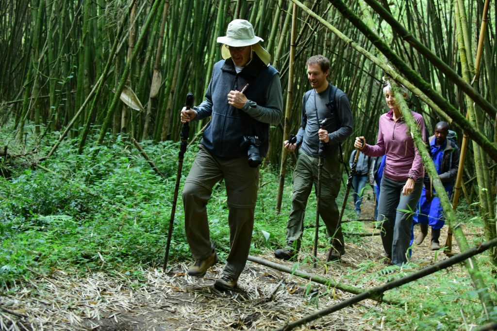
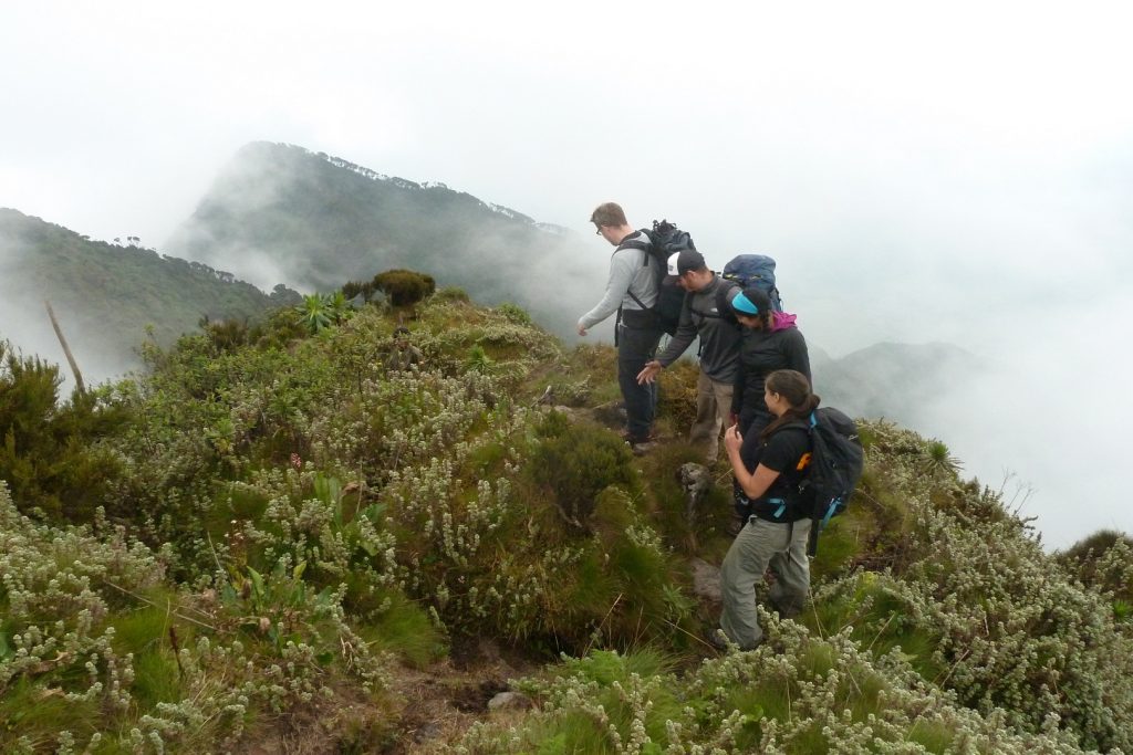
As you continue climbing Mount Sabinyo, you will experience the primary forest and the path goes up between bamboos, steeper and steeper where a light drizzle comes to cool you off! And Pale green lichen covers the branches where the group’s birdie, points at a Rwenzori Turaco, endemic to the region where its exhibiting its magnificent rainbow wings.
This is where the effort is rewarded by the stunning view between the trees and canopies which unleashing a thick could of chilling vapors as strings of fog run along the bright green, steep volcano flanks. Wooden ladders help along the way, though they can be slippery. Breaths become short with both the effort and altitude as you hear the sound of feet and sticks on the soft ground beats out the rhythm.
Down in East, houses, trees, farms and fields sketch lines and squares. Rwanda, the Switzerland of Africa and in Uganda, green and wild as far as the eye can see. The contrast is visible from the sky where you now stand and shine – with sweat, time to recover, and have a look ahead. The brown trail follows the wide, saddle-shaped ridge between the two peaks, down and up again. More ladders to come.
As your concluding your climbing to the peak 111 is steep with several ladders and mush scrambling. You are guaranteed to get your hands dirty en-route to peak111! Once on top, you will be in Rwanda, Democratic Republic of Congo and Uganda, where the time zone will change since Uganda is ahead 1 hour to Rwanda where you experience a triple countries at a go.
The journey takes about eight hours round trip to cover the 14km stretch. For all adventure lovers, mount Sabinyo can be a good choice for a hike as it offers various sightings of the various wild animals’ species in the forests along its slopes. Feeling of victory is immense while on the top of Mount Sabinyo, where you realize the true beauty of the pearl of Africa mainly because of the stunning panoramic views of the unique scenery in Uganda and a view of Uganda, Rwanda and democratic republic of Congo. This is where the arbitrariness of borders seems even more absurd when nature is so overwhelming. Yet the tiny tidy fields and farms in Rwanda are a reminder of how borders can dictate people’s destiny.
We enjoy our lunch and some more rays of sun at 3668m. It is hard to fully realise that we are in three countries at the same time. The arbitrariness of borders seems even more absurd when nature is so overwhelming. Yet the tiny tidy fields and farms in Rwanda are a reminder of how borders can dictate people’s destiny. There are two other peaks ahead but no path to their tops, and they are in DRC. There are also two peaks waiting behind, as we must return the way we came – more than enough to fill in our afternoon. It is about 2pm when half of the group starts the ascent.
It takes us about an hour to get back to the first peak. As we wait for the rest of the group, hail starts falling, followed by heavy rain. We cram into the small thatched-roofed hut. Far back, we can see patches of colour climbing down the second peak’s ladders. The rain finally stops and we set off with those who feel unwell and a few others. The after-rain light in the pale green lichen, like tree curtains floating in the gentle breeze, is breath-taking. Between the trees, volcano peaks stand out in the forest. The sun sometimes pierces through the clouds and reveals the profound, bright green of the tree tops. The descent is tough on the knees – thankfully we have retrieved our bamboo pals. The wet (and tricky!) ladders help us down the way. Our thinned out group progresses well, our bottoms sometimes hitting the muddy ground as our feet slip away.
BOOK NOW