This is one of the eight volcanoes known as the virunga Ranges standing tall as the second highest peak in the Volcanoes National Park. It rising to 4,127 metres high, Muhabura is the third highest and is the most easterly of the eight major mountains of the Virunga ranges. It is an extinct volcano and lies on the border between Rwanda and Uganda. It lies within part of the Albertine Rift, the western branch of the East African Rift. It lies partly in Volcanoes National Park (PNV) of Rwanda and in Mgahinga Gorilla National Park in Uganda.
BOOK NOW
The name Muhabura comes from the local language, Kinyarwanda, which probably is derived from a historical use of the mountain to aid navigation and the native of Kisoro district it means
The Guide to hiking Mount Muhabura
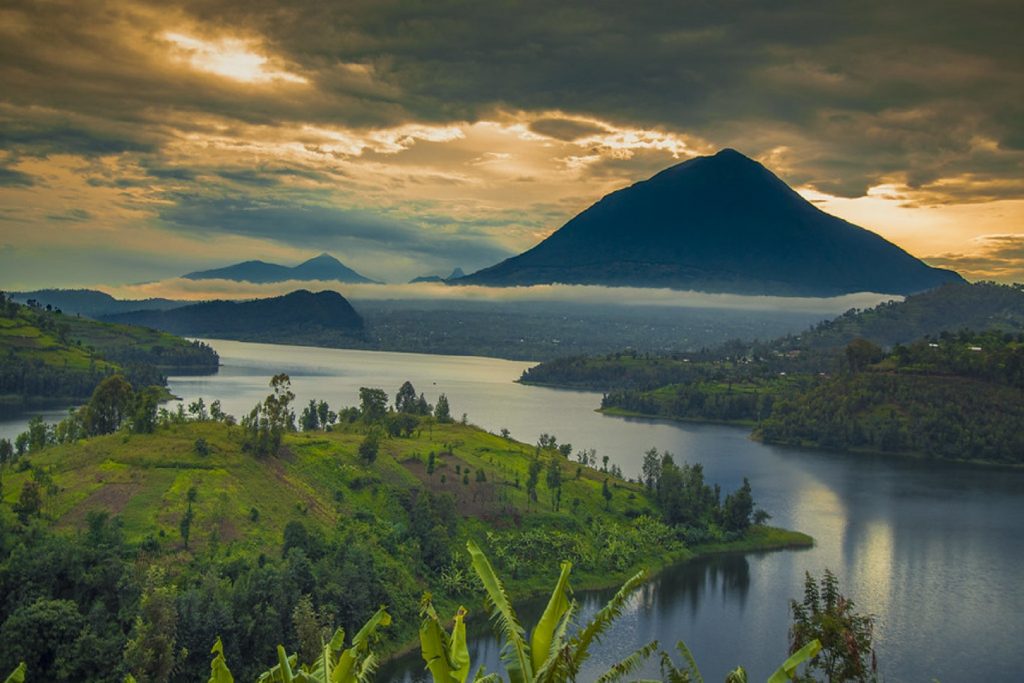
Mount Muhabura’s peak can be seen from many parts of Uganda and Rwanda because of its high slopes where one can enjoy a stunning view. Views of the other five volcanoes and the twin lake, with very beautiful and amazing views of the volcanoes, Lake George and Lake Edward in Queen Elizabeth National Park, the Rwenzori Mountains, and the Bwindi Impenetrable Forest.
The scenery from the Muhavura (also known as Muhabura), is simply breathtaking. A crater lake near the summit and the vegetation is usually drier than in other areas of the Volcanoes National Park, with giant heather thriving on the volcano’s slopes.
Mount Muhabura can be hiked within one day. It is the most interesting because while at the peak, tourists are rewarded with the breathtaking views of the other volcanoes and the twin lakes of Ruhondo and Burera. This is where Muhabura is connected to Mount Gahinga by a wide saddle in the west with a crater lake of approximately 40 meters at its summit. This can be climbed from both Uganda and Rwanda.
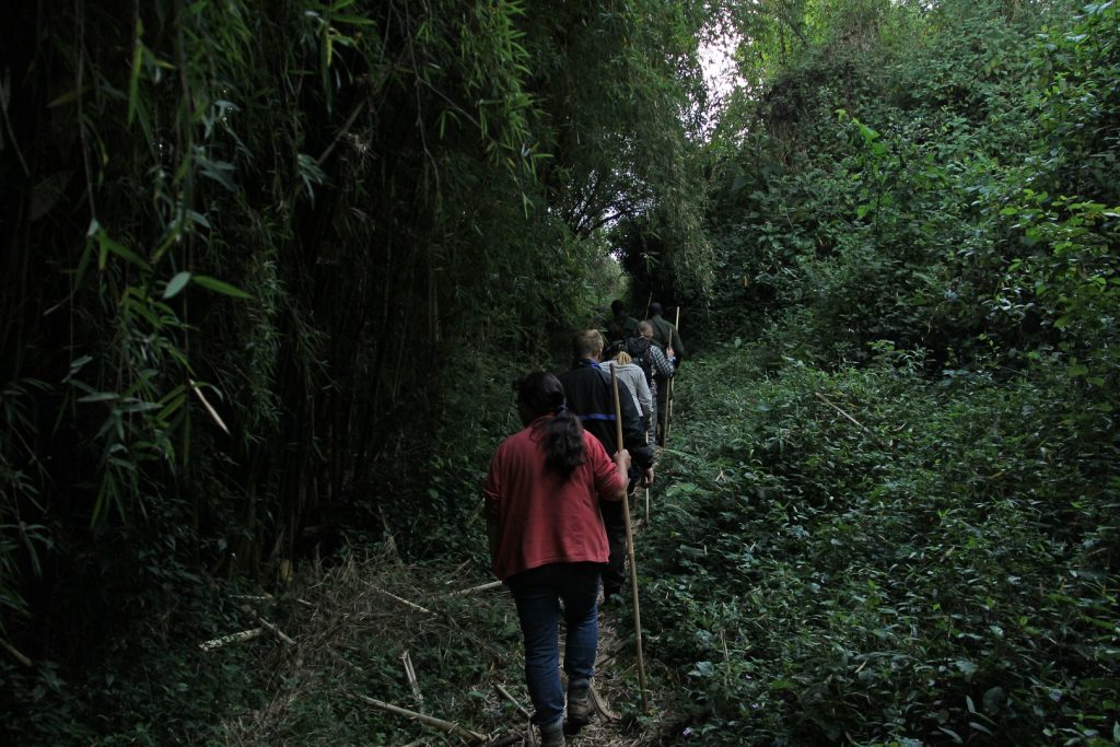
The process of hiking applies to both countries and hiking through mount Muhabura usually takes a full day but it also requires tourists to be physically fit (basic fitness) and it usually starts by checking whether you have the right hiking gears and supplies which include; packed lunch/snacks, drinking water is also handy, hiking boots, long trousers, long sleeved shirts and walking stick to support you on the slopes among others.
While here, you then report to the park headquarters at Kinigi for pre-hiking briefing as you apply to hike from Uganda where you arrive for briefing at Ntebeko Visitor Center by 7 am. This briefing involves explaining the formation and history of the Mountain, hiking guidelines, tips on how to deal with injuries and what to expect as you climb to higher elevations.
Then continue to the trail head at the base of the volcano where you will start from. The hike is conducted in the company of armed soldiers (to protect you from wild animals like Elephants and buffaloes, which are scared by shooting in the air). Each hiker is also armed with a walking stick, which the locals in Kisoro refer to as ‘enkoni’. This would be helpful for support on the steep slopes and tour guides.
Hiking is divided into two stops (each with a hut) before reaching the summit. The first stop is at 3116 meters/10223 feet above sea level and the second one being at 3855 meters/12648 feet above sea level. The climax/peak of the climb is at 4,127 meters/13,450 feet above sea level. You will be among the victorious one s to reach up to the peak because some climbers/hikers stop at the first hut while others at the second. The peak is cold and misty but because of the climb. The peak is cold and misty, where the temptation to swim in the Crater Lake became high which is truly fantastic and unique experience
BOOK NOW